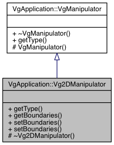
Allows to customize the Vg2DManipulator.
More...
Allows to customize the Vg2DManipulator.
For example, if you wanted to change the minimum altitude to 100
std::string lCurrentManipulator = lApplication->editManipulatorManager()->getCurrentManipulator();
if (lManipulator != NULL || lCurrentManipulator == "2D")
{
}
- Version
- 2.1.0
| virtual VgApplication::Vg2DManipulator::~Vg2DManipulator |
( |
| ) |
|
|
inlineprotectedvirtual |
Retrieves the current boundaries of the camera.
- Parameters
-
| pMinimumPosition | Updates with the minimum latitude, longitude, and altitude the camera is allowed to move. |
| pMaximumPosition | Updates with the maximum latitude, longitude, and altitude the camera is allowed to move |
- Returns
- true.
| virtual std::string VgApplication::Vg2DManipulator::getType |
( |
| ) |
const |
|
pure virtual |
Set the boundaries where the camera can move.
If the current camera position is outside this new boundary, the camera will be moved inside this new area.
The original values for the manipulators are set on the vg_config.xml or via the default values of the dataset It is usually smaller than that found on the dataset.
- Parameters
-
| pMinimumPosition | Minimum latitude, longitude and altitude the camera is allowed to move. |
| pMaximumPosition | Maximum latitude, longitude and altitude the camera is allowed to move. It supposes the all the values are greater than the values in pMinimumPosition |
- Returns
- true.
- See Also
- VgEngine::VgIDatabase::getCurrentDatasetDescriptor
| virtual bool VgApplication::Vg2DManipulator::setBoundaries |
( |
const std::vector< VgEngine::VgPosition > & |
pPositions, |
|
|
bool |
pAutoComputeMaxAltitude |
|
) |
| |
|
pure virtual |
Set the boundaries where the camera can move.
If the current camera position is outside this new boundary, the camera will be moved inside this new area.
The original values for the manipulators are set on the vg_config.xml or via the default values of the dataset It is usually smaller than that found on the dataset.
- Parameters
-
| pPositions | Set of positions used to compute the boundaries. Note: the boundaries will be the bounding box of these positions, not the exact polygon described by them. |
| pAutoComputeMaxAltitude | Pass true to compute the best altitude automatically, using VgICamera::getViewpointFromPositions. |
- Version
- 2.1.4
The documentation for this class was generated from the following file:
 Public Member Functions inherited from VgApplication::VgManipulator
